
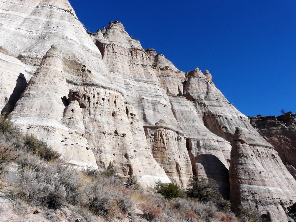
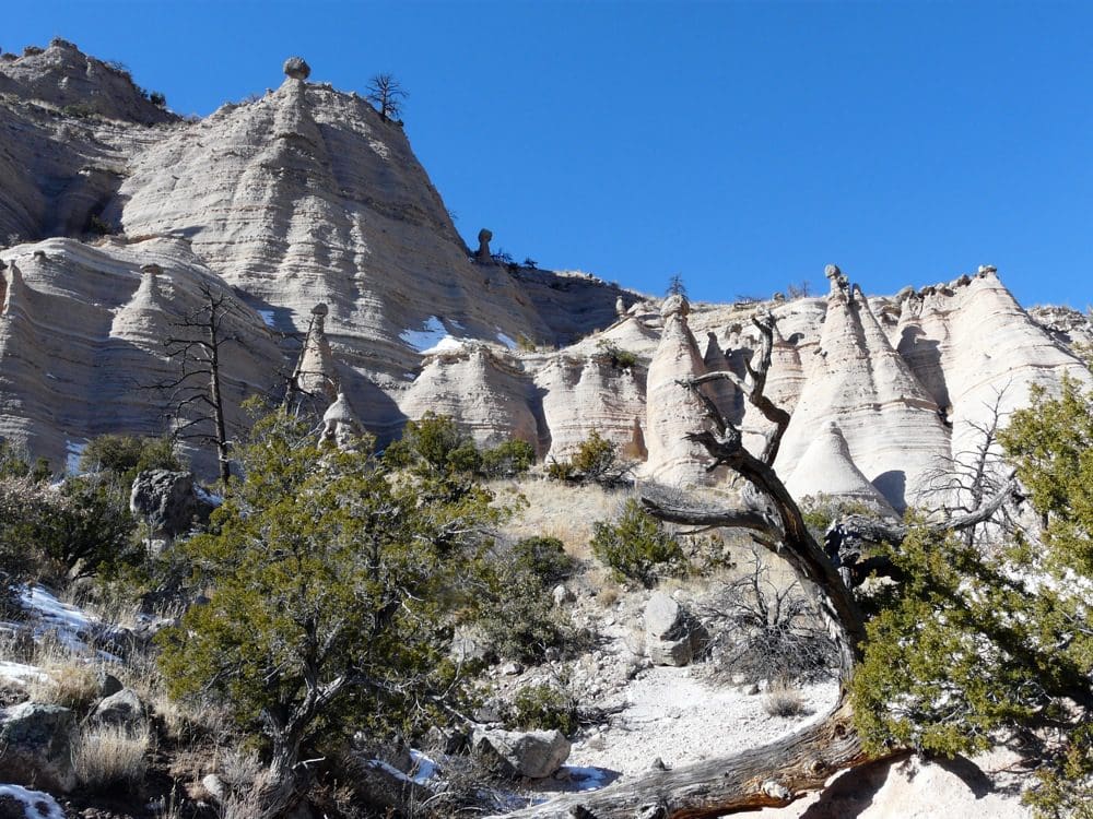
Kasha-Katuwe Tent Rocks National Monument

A trip can brighten the holidays!
It is highly unlikely that most readers have ever heard of Kasha-Katuwe Tent Rocks National Monument, one of New Mexico’s most fascinating but little known monuments. You won’t find it shown in the Rand McNally Road Atlas at all, and you’ll have to search diligently to locate its listing in the New Mexico TourBook, where it appears only under Cochità Pueblo.

The site lies west of Santa Fe and north of Albuquerque in a hidden-away location. All this confusion comes as a result of this National Monument inexplicably being “administered” in virtual anonymity by the U.S. Bureau of Land Management rather than the National Park Service, which are both agencies within the same Department of the Interior. I won’t get into the ridiculous governmental misdirection responsible for this mess, other than it is unlikely to change in the near future.
After you find Kasha-Katuwe, however, you’ll discover a truly magnificent fantasyland of cone-shaped (think of Indian tee-pees as the predominant tent shape here) volcanic rock formations. These formations have been sculptured handsomely through the centuries by Mother Nature’s forces of water and wind erosion.

Vegetation ranging from large Ponderosa pine tress to small desert plans decorates the site. The monument can be easily explored on the mostly level, 1.2-mile Cave Loop Trail, while student groups and more adventurous adults can opt for the steep and significantly more difficult 3-mile Canyon Trail, which climbs a narrow slot canyon. Although the latter requires an elevation gain of some 630 feet along the way, the advanced hiker will be rewarded with splendid panoramic views of the Monument and surrounding countryside when reaching the summit.
Either way, temperate New Mexico winter weather is sure to help provide a rewarding sightseeing experience here minus the summertime heat.


You May Also Like


About Us
We're The Group Travel Leader, America's leading experts on all things group travel. Find hundreds of articles, podcasts and other free resources for your group travel program here.
The Latest Issue
Stay Connected!
Get the Group Travel Minute e-newsletter twice a month.